


4 Geographical maps of the Franco-German war, 19th century

.png)
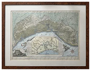
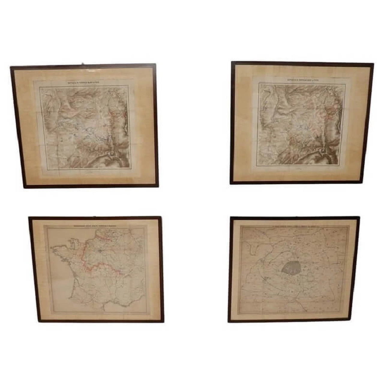
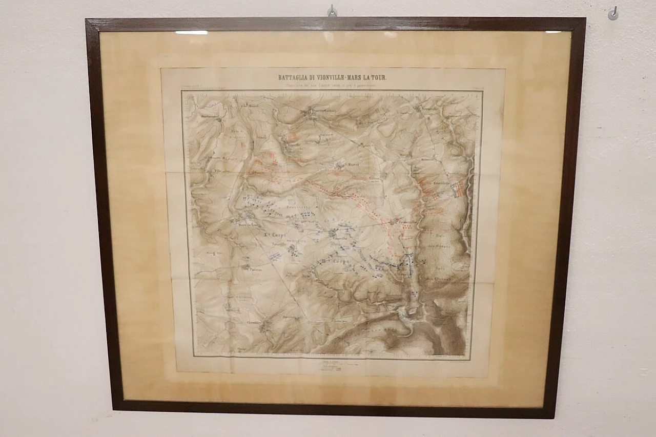
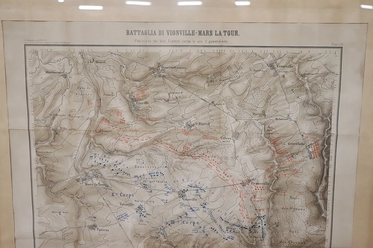
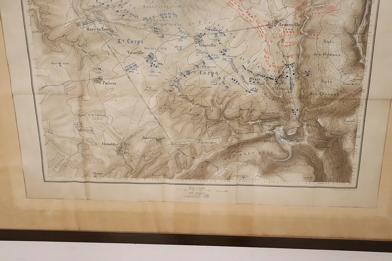
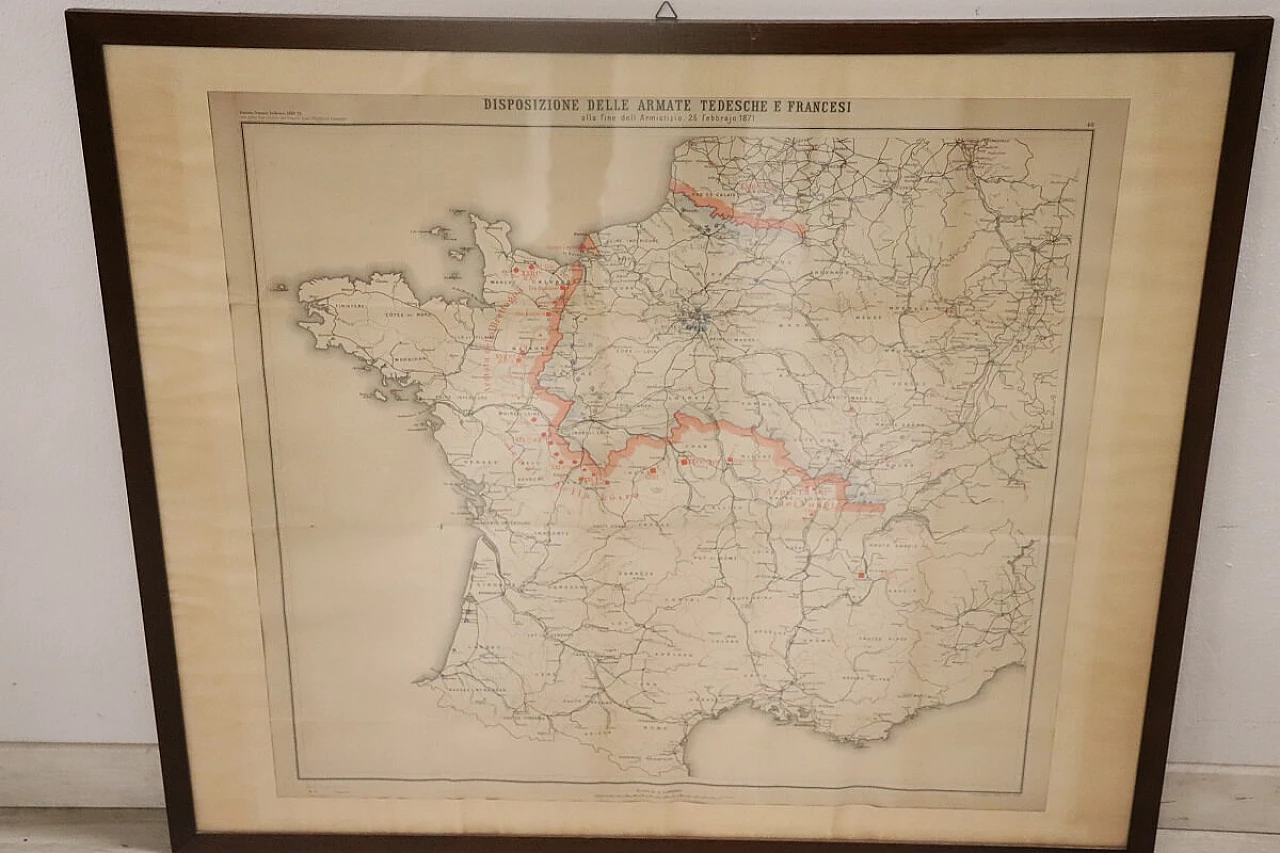
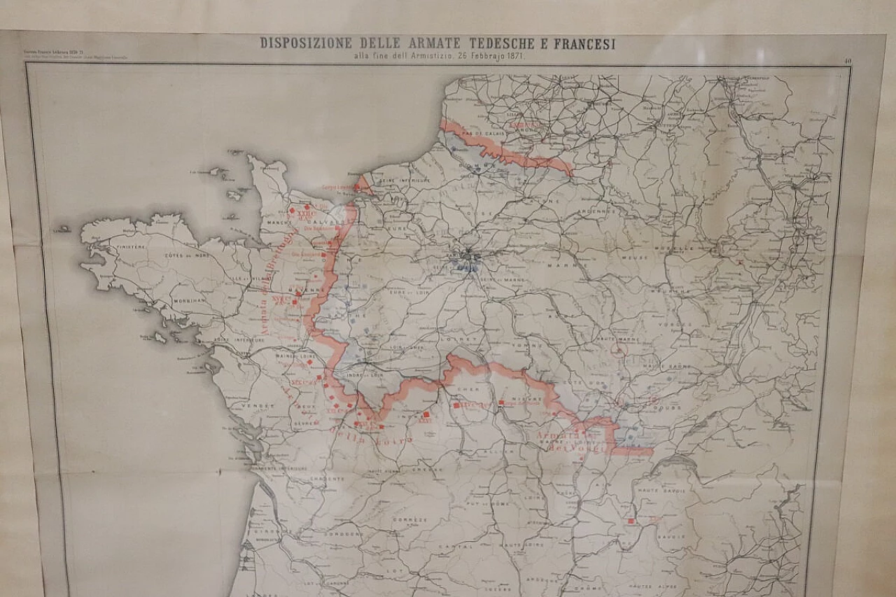
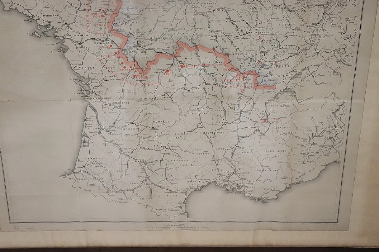
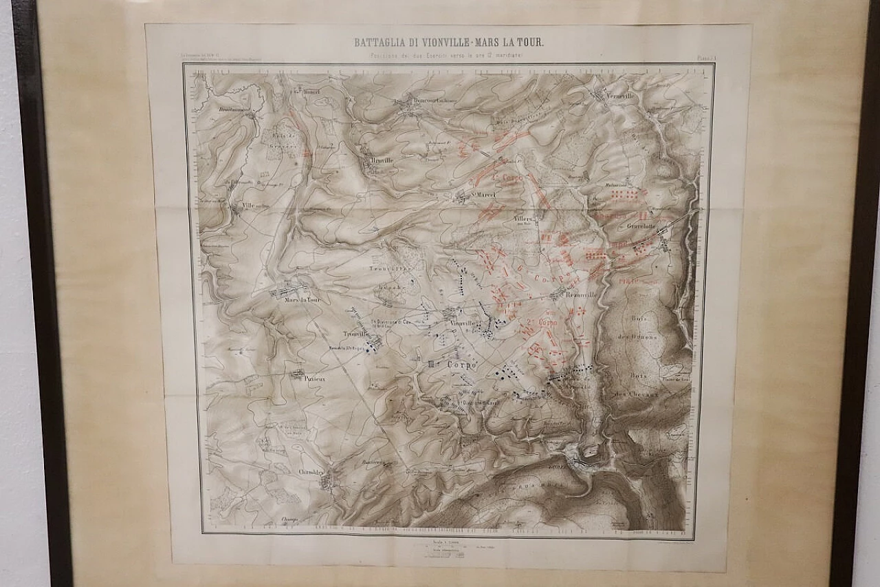
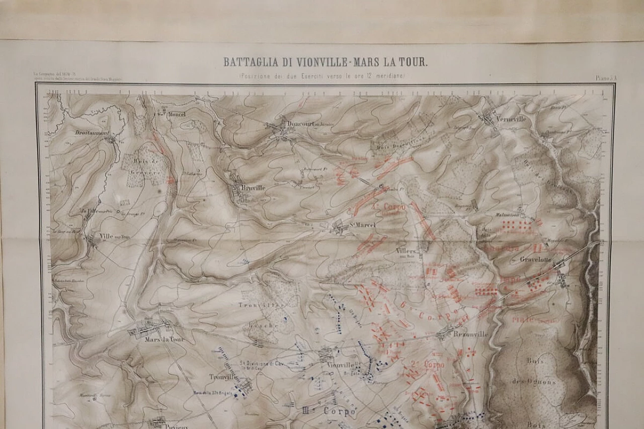
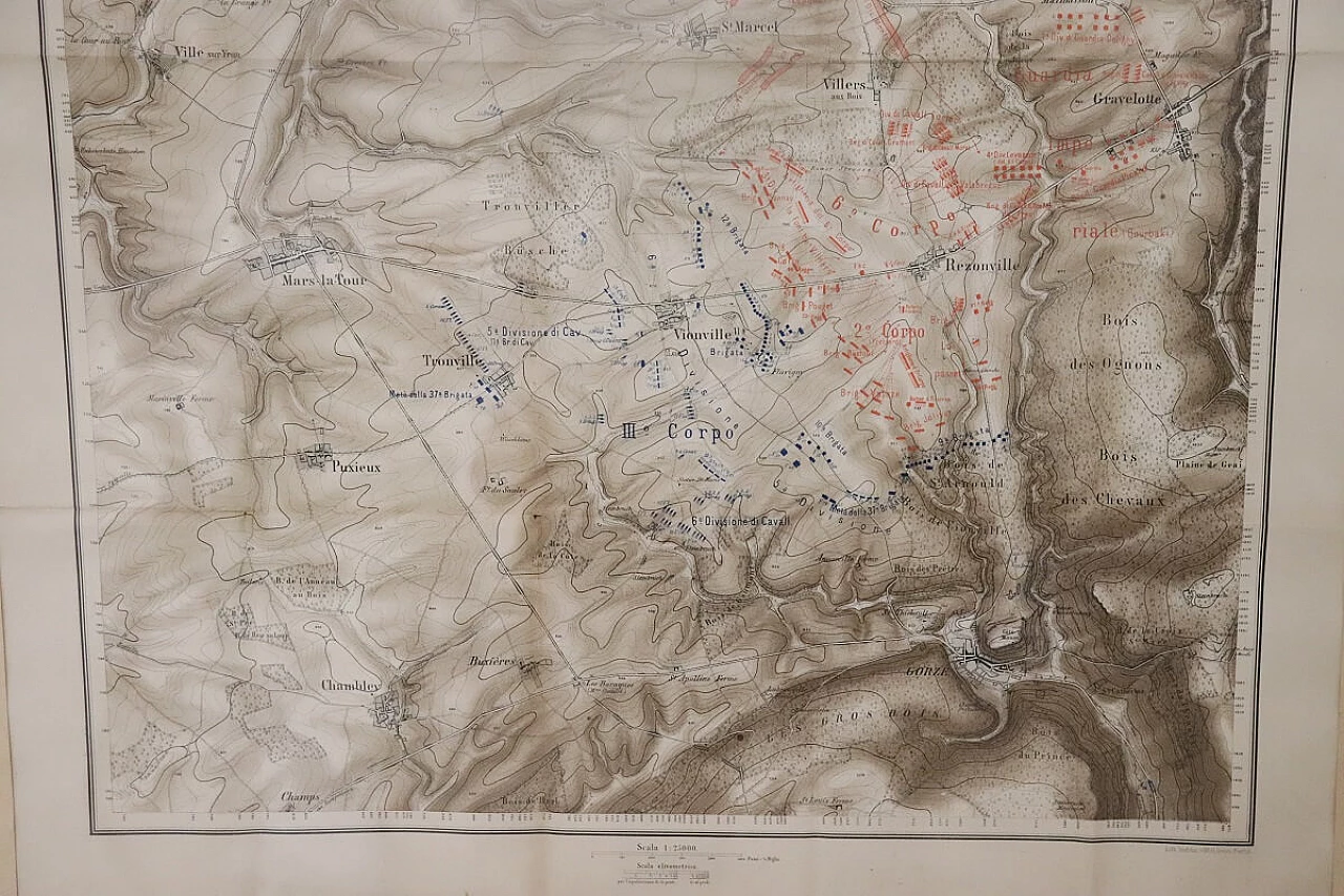
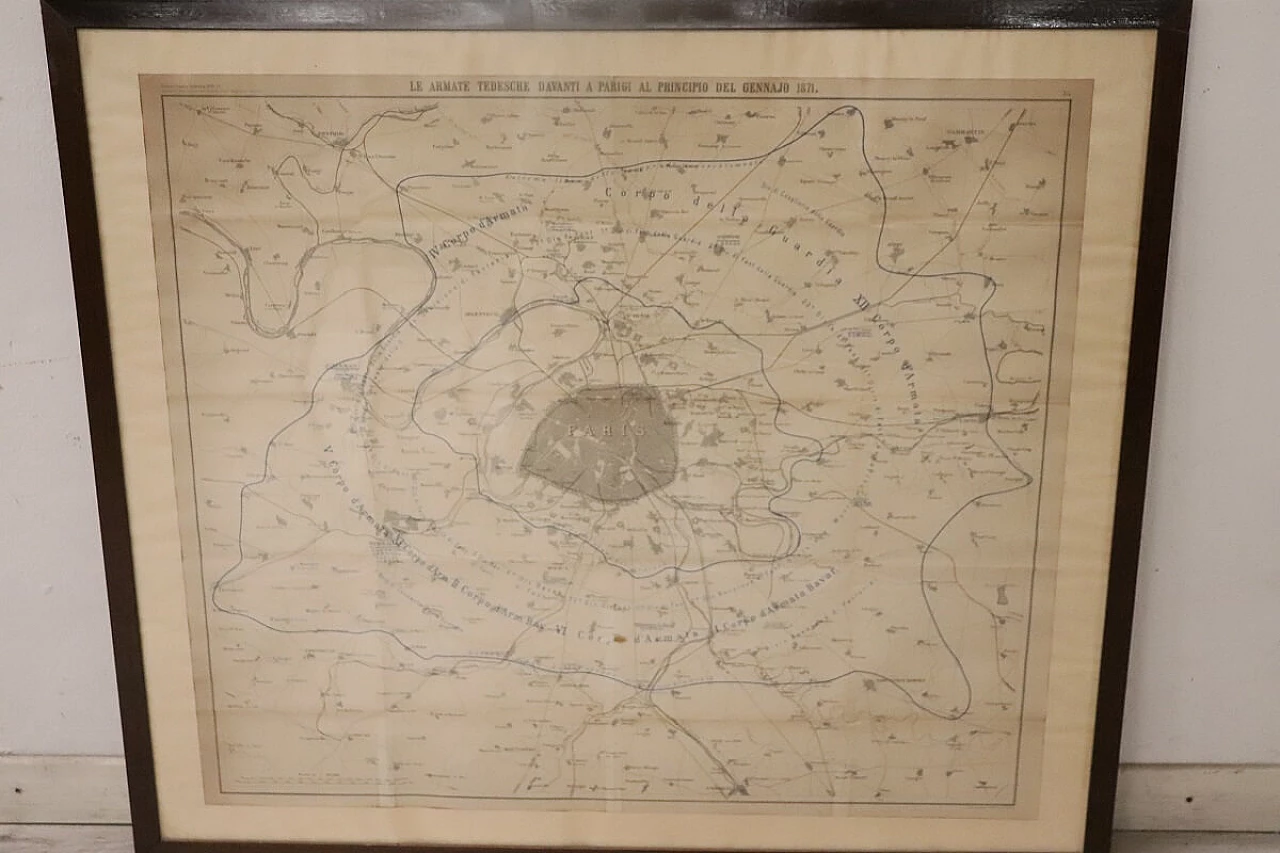
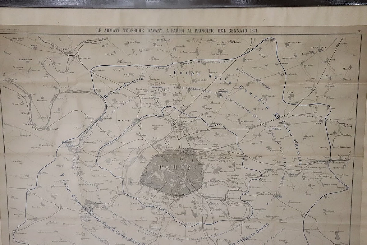
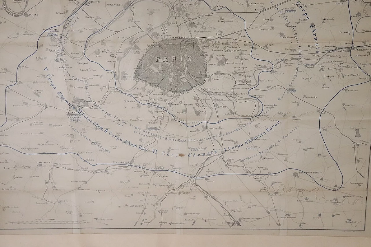
Set of four prints with geographical maps relating to the positioning of the armies in the Franco-German war (1870-71), 19th century. Author: Historical Section of the Great General Staff. Publisher: Lith Institut Wilh Greve. Equipped with a recently manufactured wooden frame. Good general condition; yellowing of the paper. The measurements indicated include the frame. Offered at a negotiable price, we invite you to send us your purchase proposals which we will happily evaluate. Professional packaging - insured shipments with couriers - delivery by appointment - street level only, no porterage to floors.
ID: 1372-1709205736-84725
Time period

 SILVER Seller in Alessandria, Italy