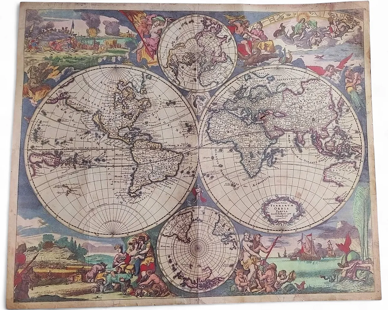
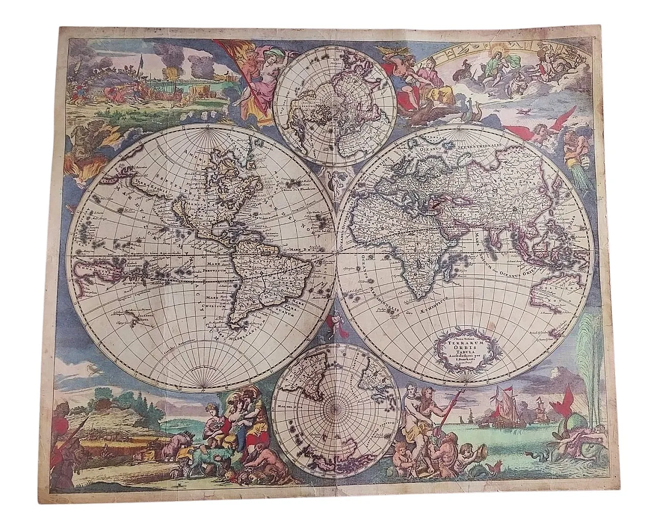
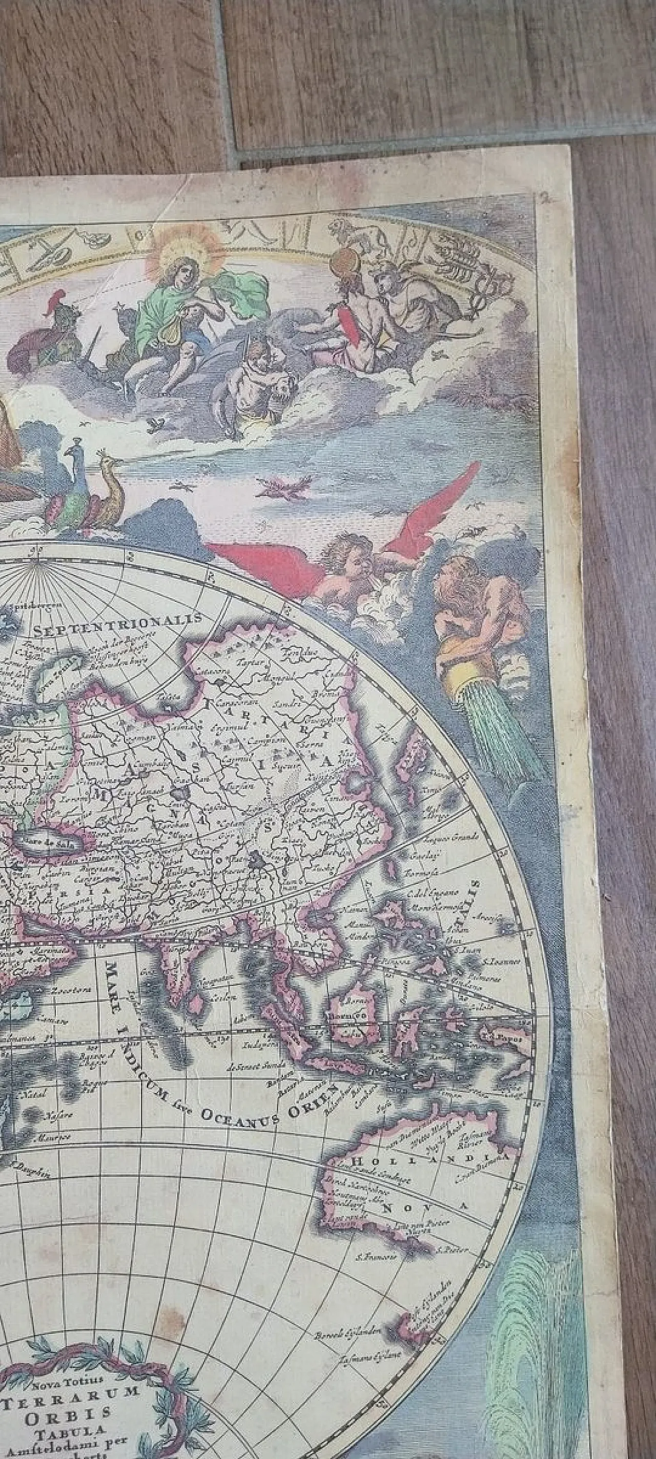
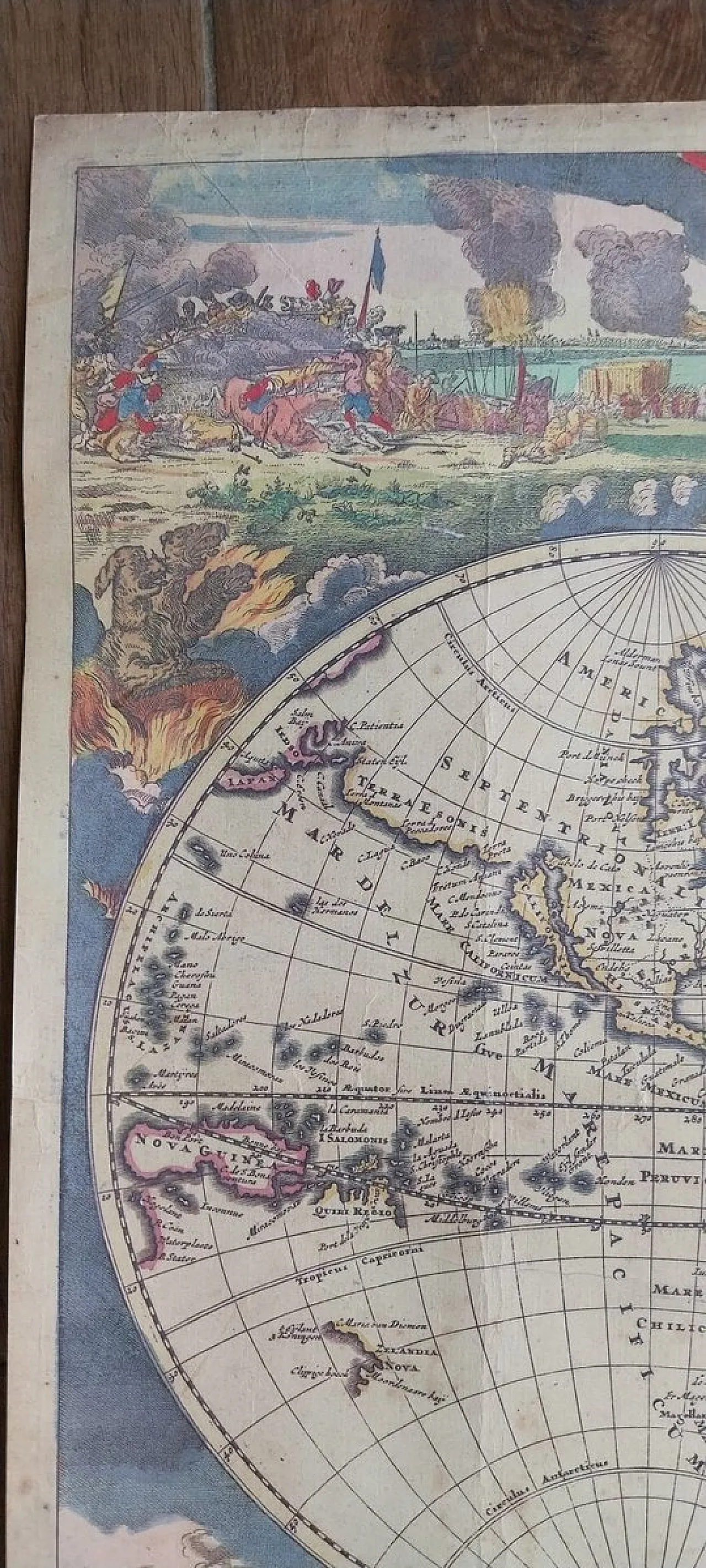
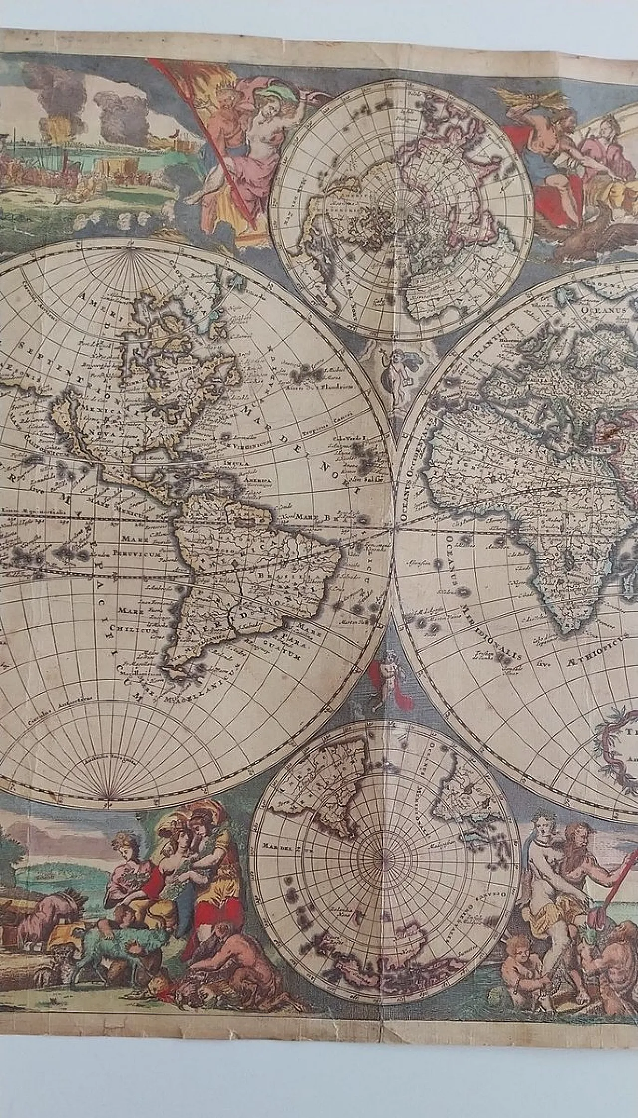
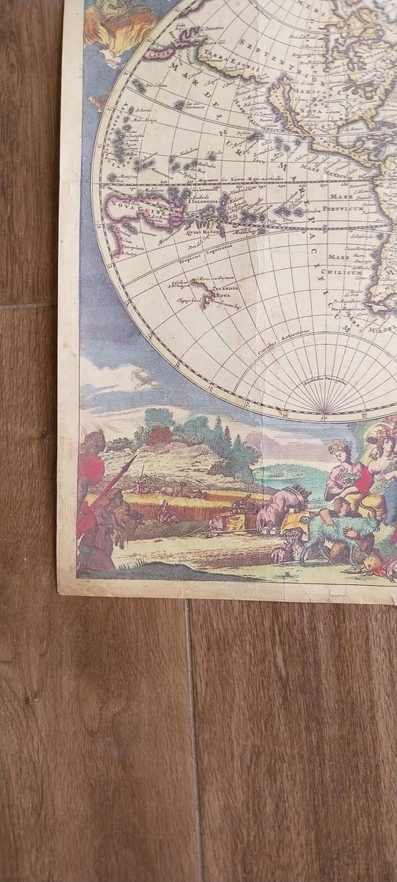
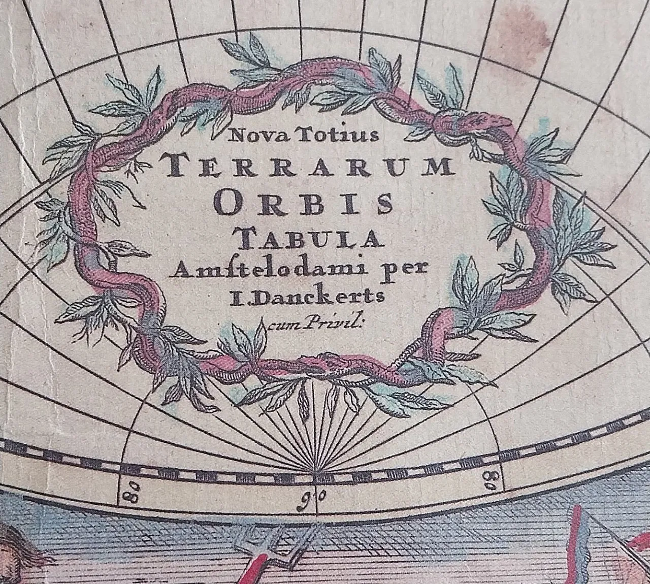
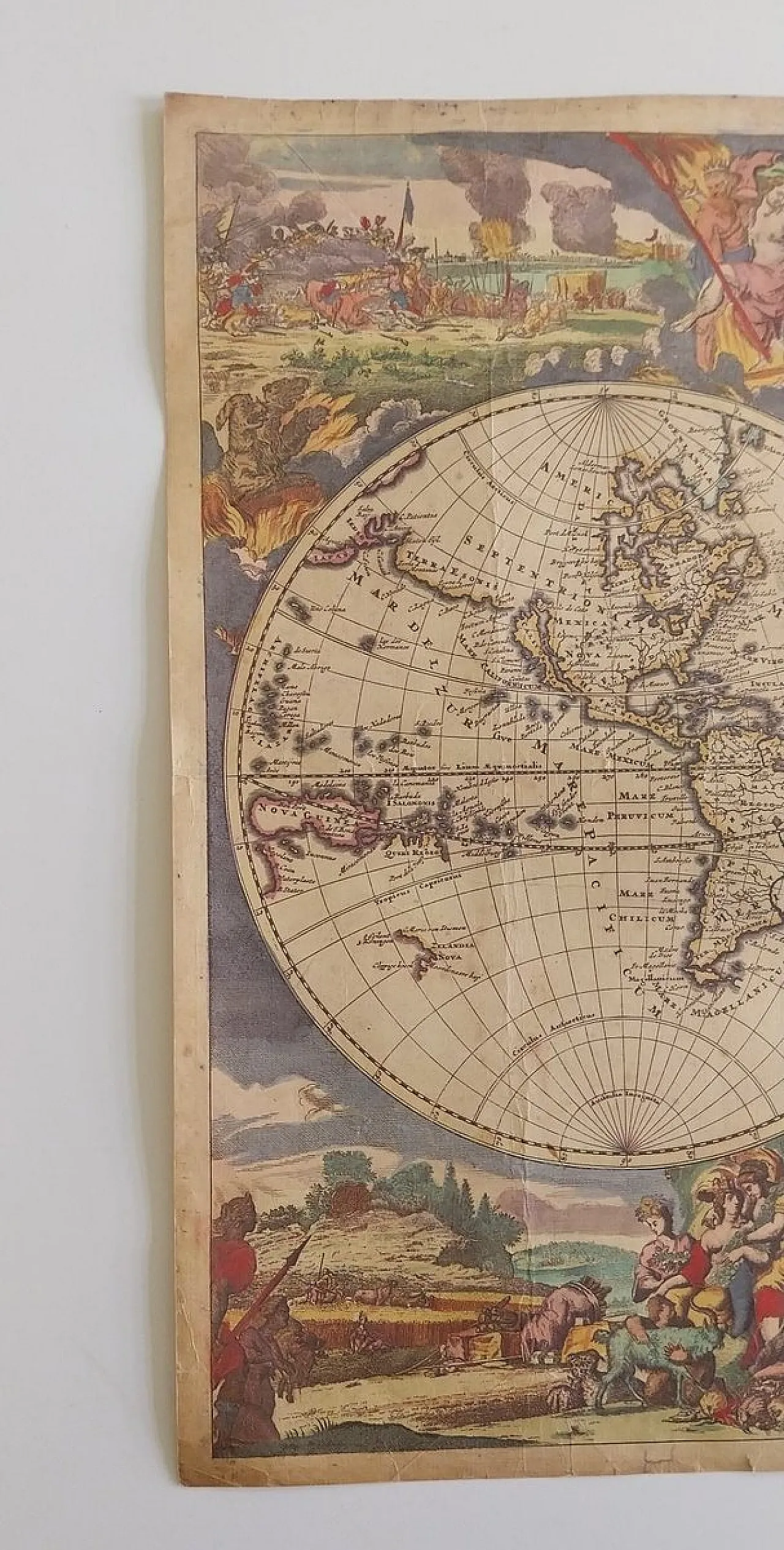
Justus Danckerts (1635–1701) Nova Totius Terrarum Orbis Tabula, Amsterdam, c. 1680–1700 Copper engraving with original contemporary hand-colouring; double-hemispheric world map Plate size: approx. 51 × 60 cm A highly decorative Baroque world map from the Dutch Golden Age of cartography, produced in the Amsterdam workshop of Justus Danckerts. The map presents two large hemispheric projections surrounded by richly ornamented allegorical scenes representing the four continents, together with military motifs, ships, and mythological sea creatures — all characteristic features that place this map among the most visually engaging world maps of the late 17th century. The cartography includes several well-known geographical misconceptions of the era, most notably the depiction of California as an island and the incomplete outline of New Holland (Australia). The engraved lines remain sharp and legible, while the preserved original hand-colouring enhances the decorative appeal of the sheet. Condition: Paper with signs of age; visible folds and minor marginal creasing. Small tears and traces of old adhesive tape on the verso, with some discolouration in the central area. No significant loss of paper; the original colouring remains vivid and stable. Suitable for professional conservation treatment. Note: This map is one of the most celebrated and desirable decorative world maps from the Danckerts workshop and an important example of late 17th-century Dutch cartographic production.


.png)


 SILVER Seller in Slovenia, Slovenia